Your trusted GIS firm for unmatched geospatial performance
Since its inception in 1989, our GIS firm has been driven by a singular mission: to help organizations unlock the full potential of their geospatial data.
We leverage our extensive expertise in FME and ArcGIS to inspire GIS leaders, providing them with the tools and knowledge they need to elevate their departments and make a lasting impact within their organizations.
This commitment drives us to tackle challenges that are as complex as they are diverse, inspiring innovative solutions every step of the way.

Our values
At Consortech, our values inspire everything we do, shaping our approach to innovation and collaboration. These guiding principles reflect our commitment to delivering exceptional solutions and building lasting, meaningful relationships with our clients.
EXCELLENCE
At our core, we’re all about delivering outstanding services while reaching for the stars! We’re committed to continuous improvement and having fun while we’re at it!
RESPONSIBILITY
We’re all about accountability. That’s why we take ownership of the scope and impact of our actions on our client’s success.
COLLABORATION
We’ll always choose collaboration over competition. Every challenge is an opportunity for us to join forces with our colleagues, clients, and partners.
OPENNESS
We thrive on fresh perspectives and opinions. By embracing input from all our stakeholders, we can elevate our work and evolve for the benefit of all.
DARING
We’re not afraid to trust our gut and step out of our comfort zone. Innovation is driven by the courage to take risks and the willingness to learn from our mistakes.
The beginning of a transformative journey
THE BEGINNING OF A TRANSFORMATIVE JOURNEY
Geomatics was still in its infancy, but emerging technologies motivated Pierre Genest to start a business whose mission was to introduce new technology at the municipal level. Consortech initially focused on developing a property assessment system. That system is still in use today and updated by our team.
At that time, cities had no or very little geospatial data. We therefore quickly hired our first geomatics specialists. They helped and equipped our clients to produce map data.
DREAMING OF INTERNATIONAL MARKETS
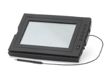
Before mobile technologies and applications became widely available, Consortech took a pioneering leap by developing PortaCAD — a cutting-edge CAD software designed to revolutionize field data collection. This innovative tool operated seamlessly on our GRID-brand electronic tablets, complete with a stylus that we proudly distributed.
As demand soared, Consortech experienced remarkable growth, successfully introducing PortaCAD across Ontario, British Columbia, the United States, and even Bermuda. With our sights set on the global stage, we launched ambitious promotional campaigns that reached as far as France and China.
A new era of service and expertise
![]()


A NEW ERA OF SERVICE AND EXPERTISE
The municipal IT solution market tightened, and our dreams of commercializing PortaCAD didn’t materialize as we’d hoped. Instead of dwelling on setbacks, we embraced the opportunity for growth and innovation, shifting our focus to distributing value-added products.
During this time, we forged strong partnerships with MapInfo, Safe Software (FME) and Bentley. This strategic pivot paid off, as we swiftly became Bentley’s largest partner in Quebec and launched MicroStation-based solutions for geomatics, civil engineering, and plant engineering.
![]()
TURNING ROADBLOCKS INTO OPPORTUNITIES
Bentley, our primary supplier, decided to eliminate its reseller network. This forced us to take a hard look at our strategy and adapt to the changing landscape. Seizing the opportunity, we forged a game-changing partnership with Autodesk. This collaboration propelled us to the forefront as Quebec’s top geomatics reseller and positioned us as a leader in the integration of cutting-edge Civil 3D technology.
EXPLORING THE FASCINATING WORLD OF BIM
Our company saw remarkable growth after securing service contracts with key Quebec government departments and institutions.

Always on the lookout for new opportunities, we expanded our Autodesk product and service offerings to better support clients in the architecture, engineering, and construction (AEC) sectors. Our Revit software expertise led us into the world of BIM, where we played a pivotal role in promoting the adoption of this cutting-edge approach across Quebec.
A STRATEGIC SHIFT FOCUSED ON GROWTH
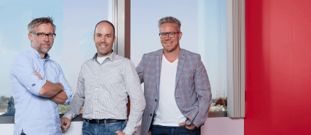
The company’s founder, Pierre Genest, took a bold step by establishing a business succession plan that included Rémy Pelletier, Guillaume Genest, and François Laganière.
Driven by our ambition to make an impact on the industry, we shifted our focus to geospatial ETL consulting and BIM support services. This strategic shift propelled our growth and allowed us to thrive in the Ontario market.
NEW LEADERSHIP, NEW HORIZONS
In 2014, Consortech saw a shift in its shareholder structure, with Rémy Pelletier taking the lead alongside two successors.
Three years later, the company made the bold decision to focus on geospatial data integration, selling its Autodesk product resale division.
CELEBRATING GROWTH BEYOND QUEBEC
In 2018, Consortech began exporting its expertise from coast to coast. As Safe Software’s sole platinum partner in North America, we forged strong relationships with new clients in Ontario, Western Canada and the United States.
![]()
Our team took their unique FME expertise on the road, touring several American cities and getting involved with a wide variety of organizations, conferences, and so on. These efforts paid off. As the company celebrated 30 years in business, over 40% of our revenue was generated outside Quebec.
COMMITTING TO OUR IDENTITY AS A GIS FIRM
Guillaume Genest and François Laganière took the helm of Consortech as sole shareholders. They aligned behind a single vision: to propel the company forward by focusing on geospatial performance.
CELEBRATING A NEW MILESTONE
With over 30 years of excellence in the geomatics field, Consortech proudly achieved Silver partner status with Esri, highlighting our long-standing commitment to The Science of Where™ and our expertise in leveraging the Esri ecosystem.
BRINGING OUR GIS EXPERTISE ON THE ROAD
Our team embarked on an exciting journey as we leveraged our unique expertise in FME and ArcGIS. During this time, we successfully expanded into the North American market, generating excitement and new opportunities along the way.
![]()
LOOKING TO THE FUTURE
As we commemorate 35 years of business, we’re thrilled to embark on a new chapter in our journey. In 2024, François Laganière took over as President, steering us toward a bright future filled with fresh opportunities. We’ve also revamped our leadership team, strengthening our commitment to better serve our clients.
Looking back, it’s truly inspiring to see how much has changed over the years. While technology has evolved and our services have expanded, our core mission remains the same: empowering GIS leaders to leverage their geospatial data for the benefit of their organizations and communities.

Elevating geospatial performance across North America
As a leading GIS firm, we leverage our extensive expertise in FME and ArcGIS to help clients across Canada and the USA enhance their geospatial performance and meet their unique operational goals.
Our dedicated team specialize in automation, integration, planning, and governance, bringing practical, real-world insights to tackle the unique challenges faced by local governments, utility providers and various industries.
We understand that robust GIS strategies are vital for insightful decision-making. That’s why we’re committed to helping our clients unlock the full potential of their geospatial data, paving the way for smarter solutions and more effective outcomes.
OUR EXPERTS ARE HERE TO LISTEN
And offer pragmatic advice and solutions adapted to your reality.