Carve your GIS department the space it deserves
GIS is a booming industry! In addition to creating value for organizations, GIS also benefits the community as a whole.
With Consortech’s help, GIS departments can join the movement and position themselves as a strategic, essential piece of the puzzle. And it’s all thanks to geospatial performance!
Our GIS and IT experts act primarily
on three technological angles
Our GIS and IT experts act primarily on three technological angles

Stabilizing and upgrading ArcGIS and FME platforms

Optimizing and automating processes with FME

Securing ArcGIS integrations with enterprise systems
Our expertise
makes the difference
Consortech is not like other GIS consultants. We master every single aspect of automation and application integration by leveraging the complementarity of FME and ArcGIS.
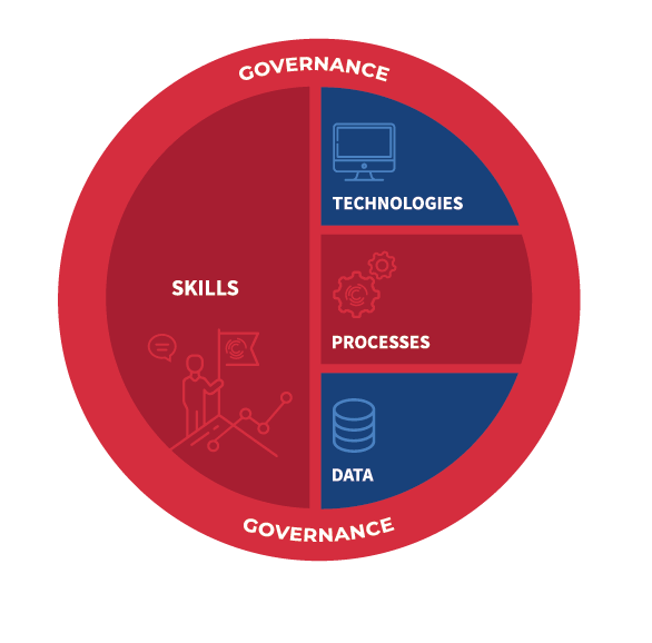
Over the years, we have developed a range of services around the concept of geospatial performance. More specifically, we support GIS leaders in balancing their investments in the five main pillars of geospatial performance.

In very concrete terms, we help decision makers put their data acquisition and technology options into perspective. We do that by optimizing and automating processes and by developing the skillsets of GIS specialists.
We also provide our clients a framework with flexible governance rules that account for their realities and organizational constraints.
The Consortech difference

Our experts’ blog
Lights on geospatial performance
FME & ArcGIS Integration: 3 Expert Tips for License Compliance
Managing software licenses in a complex IT environment, especially with ArcGIS and FME, can be challenging.

SUCCESS STORY
Flying colours for our team
Automated agricultural compensation calculation tool for a large Canadian public utility company
This large Canadian public utility company knew a smooth migration required a thoughtful approach and reliable support. They turned to Consortech for the transition.